Google Earth is a wonderful place that collects images from various sources, from satellites in orbit that take low resolution photos from tens of thousands of kilometers above Earth, to satellites closest to Earth than capture high resolution shots. The website also collects aerial photos taken by planes and drones. All these images are available to anyone who downloads the software, and archaeologists have taken advantage of this rich resource, analyzing the strangest.
From weird sprawling swastikas, to a ghost island in the South Pacific, Google Earth unearths extravagant and incredible places. Let’s take a look at the weirdest images of Google Earth.
The strangest images from Google Earth
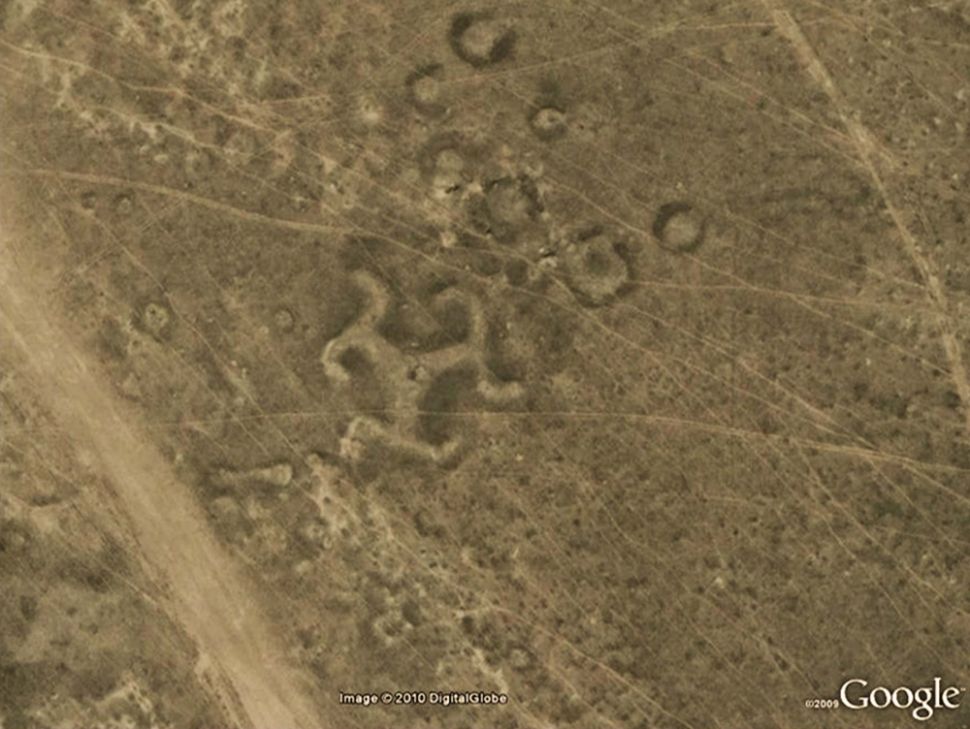
Let’s start this ranking with this image, which portrays one sprawling swastika. Scientists have discovered more than 50 geoglyphs in northern Kazakhstan, in Central Asia, including this strange swastika design. Although the swastika symbol was created from wood, many of the geoglyphs were made from mounds of earth. Geoglyphs appear to date back to 2,000 years ago. At the time, swastikas were not uncommon in Europe and Asia and they obviously weren’t affiliated with any political creed.
The island within a lake, located on an island, in a lake, on an island
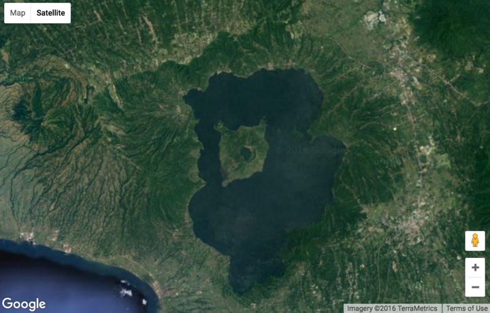
This Google Earth image is a delight for oddity lovers as it is an island within a lake which, in turn, is located on an island, in a lake, on an island. It’s a weird pun but the image will clarify your ideas – or at least we hope.
Google Earth has captured this image showing a small island that resides within a crater lake on an island called Volcano Island, in a lake called Taal lake, on the Philippine island of Luzon. For years, apparently, this phenomenon was thought to be the biggest and strangest ever captured by the ingenuity of Google Earth. It is actually much simpler and easier to understand than you might imagine.
Did the matryoshka effect confuse you even more or did you manage to survive?
Strange wheels
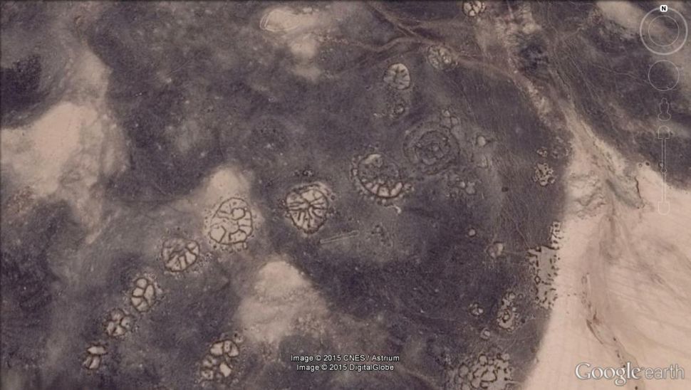
Google Earth has spied on some old works of art etched on the planet’s surface, including geometric structures in the shape of a wheel which could date back to approx 8,500 years ago, making them older than Peru’s named geoglyphs Nazca Lines.
Some of these ray designs that dot theAzraq Oasis in Jordan they appear to be positioned so align with the dawn of the winter solstice. A team of scientists from the Air Photographic Archive for Archeology in the Middle East (APAAME) has studied the structures of the wheels (also called “works of the old”) with satellite images available through Google Earth.
The wheels vary from an aesthetic point of view, offering numerous strange but fascinating designs.
The wheels of the image you can see above are located in the Azraq Oasis and have spokes with a southeast-northwest orientation, possibly aligned with the dawn of the winter solstice.
A mysterious pyramid?
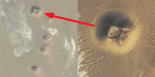
This Google Earth image shows an anomaly which some believe may be one unexcavated pyramid. Dozens of anomalies in Egypt have been detected using Google Earth over the past five years; however, there is a debate as to whether they represent natural features or man-made structures. More excavations are needed but the economic and security situation in Egypt has limited number and the size of the excavations.
The strangest images from Google Earth: the ghost island
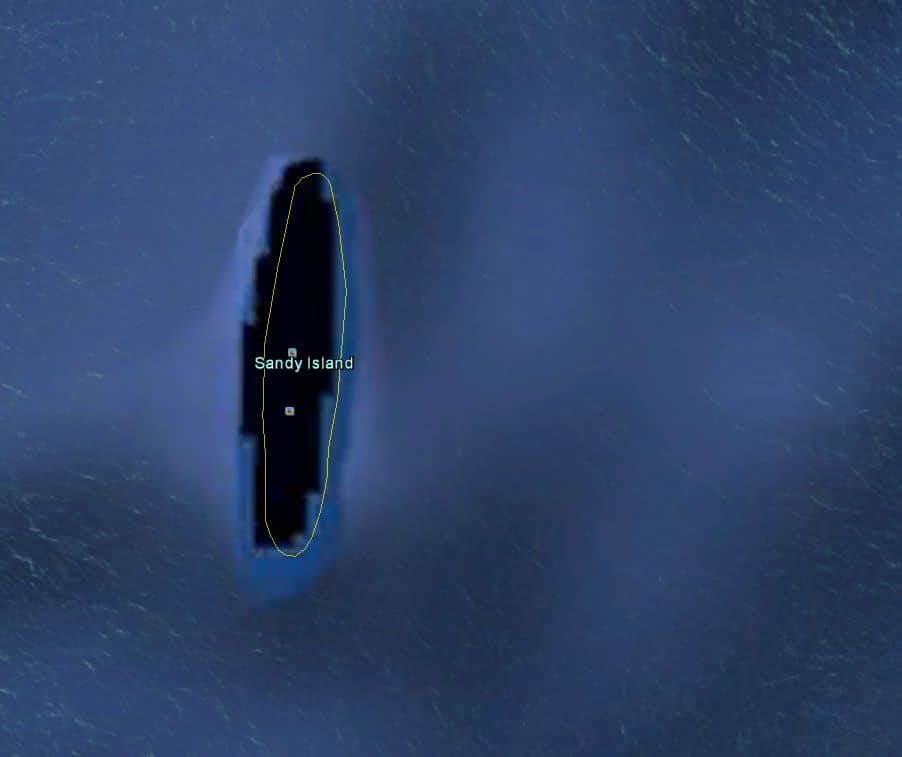
In 2012, a group of Australian researchers “discovered” a ‘an island as big as Manhattan in the South Pacific. A mysterious place called Sandy Island had popped up on the maps, northwest of the New Caledonia. It also presented itself as a black polygon on Google Earth. However, when the scientists sailed there in November 2012, they found nothing: only water, no solid earth.
In an island obituary published in April 2013, researchers explained why the ghost island had been included on some maps for more than a century. Among the possible causes have been listed some human errors and one possible pumice raft.
Enigmatic pentagram

In an isolated and remote corner of the Kazakhstan there is a great staff, which measures approx 366 meters in diameter, engraved on the earth’s surface. The five-pointed star surrounded by a circle, located on the southern shore of the Upper Tobol Basin, is also vividly shown on Google Maps, the online version of the more detailed Google Earth.
Many online comments have linked the site with devil worship, nefarious religious sects, or inhabitants of the underworld. Instead, the staff turns out to be the outline of a park made in the shape of a star; the star is marked by roads that are now lined with trees, making the shape of the park – and therefore of the star – even more distinct in the aerial photos.
Google Earth is an abandoned place
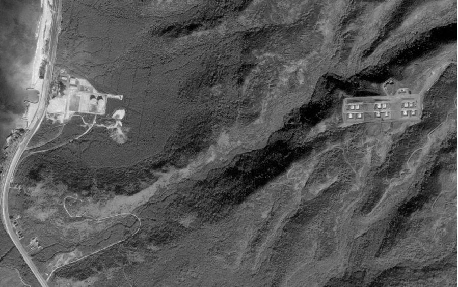
The missiles Nike, missiles supersonic ground-to-air, they were ready to launch in almost 300 sites in the United States during a particular period of the Cold War, from 1954 to the 1970s. Some of these missiles also carried nuclear warheads. However, with the advent of the long-range intercontinental ballistic missiles, this ancient type of missile has become obsolete.
David Tewksbury, a GIS (geographic information system) specialist at Hamilton College in New York, aims to preserve one visual record of abandoned Nike missile launch sites before they disappear. His plan is to build a database geo-referenziato so that anyone can search for Nike missile sites through Google Earth.
The image above shows us the Oahu Defense Area in Hawaii in 1968. The site was once equipped with open-air missiles.
Lake of blood?
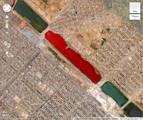
Outside Sadr City in Iraq, at coordinates 33.396157 ° N, 44.486926 ° E, there is a blood red lake. This may be the most distinctive image so far as, even today, there is no official explanation for the color of this strange body of water.
Alien bunker on the horizon?
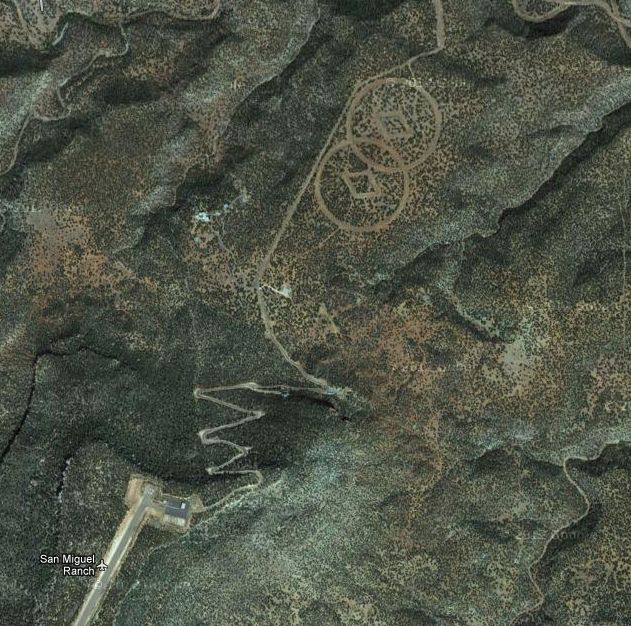
Found carved on the desert floor near Mesa Huerfanita, New Mexico, there are two big ones diamonds surrounded by a pair of overlapping circles. The author John Sweeney hhe claimed that the site scores a bunker hidden belonging to Church of Scientology.
According to their website, Scientology “is a religion that offers a precise path that leads to a complete and certain understanding of one’s spiritual nature and relationship with oneself, family, groups, humanity, all forms of life. , the material universe, the spiritual universe and the Supreme Being ”.
Such desert symbols would be there for help guide the aliens who return to Earth after escaping a planetary “Armageddon”, writes the Daily Mail. Of course, the symbols will likely remain a mystery.
A secret military base?
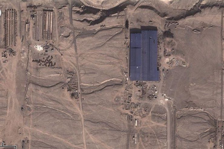
We conclude with a mysterious satellite image seen on Google Earth, which caused a sensation when a former CIA analyst told Wired that he had discovered “structures” in the desert around Kashgar, a city located in the remote western desert of China and which is part of the Xinjiang province.
Some have speculated that the buildings on the site were part of one secret military base. However Stefan Geens, a geospatial blogger who spent months in that part of China, said the site was likely part of a economic center.
If you also want to observe these strange images in more detail, you can consult the official Google Earth site.





Leave a Reply
View Comments