
Google wants to help us breathe better: in fact, the functionality that shows the air quality are Google Maps. A function for the moment intended only for United Statesbut present on both Android and iOS.
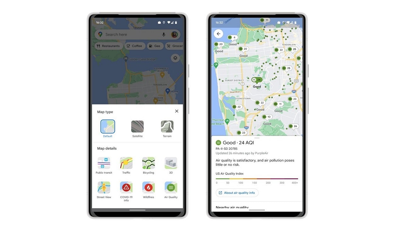
Google Maps shows the air quality on the map
Full of smog or fresh and clean? Knowing the quality of the air is possible thanks toAir Quality Index AQI, which shows the air quality with a numerical scale. Google will also add a color to the number to help understand the air quality in the area: if you have a green light, even a walk shouldn’t be a problem.
The information in the United States comes directly from Environmental Protection Agency (EPA), the government agency responsible for the environment. But also from non-governmental resources such as PurpleAir, which uses a low-cost sensor network to measure air quality locally. So you can discover the AQI district by district.
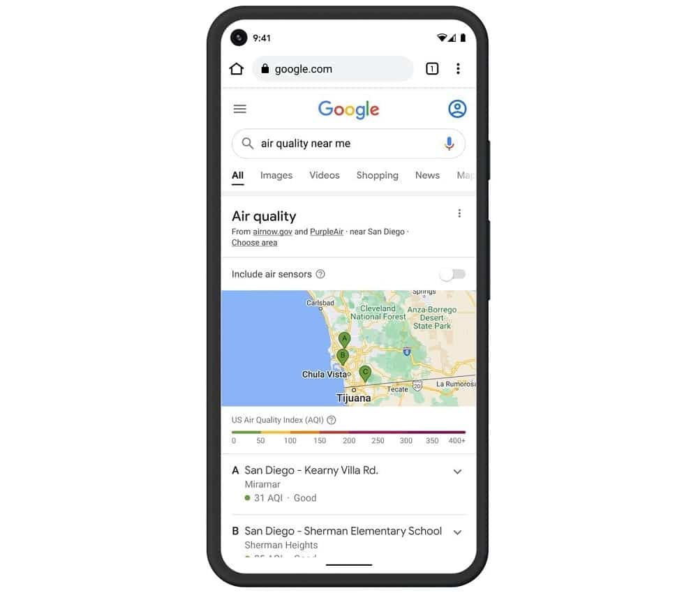
Google will also integrate the score into browser searches. This function is particularly important in the summer. The scarcity of rain increases smog. And in the United States, the outbreak of fires can make the air unbreathable in certain areas. Google also collaborates with the National Interagency Fire Center (NIFC) to warn in case of fire.
This kind of functions also require institutional collaborations. So it is difficult to understand how far air control can reach Italy. But it looks like one smart function, which Google will certainly export. We will keep you informed as soon as there is more information.